Geolocate

Lauerzersee topographic map

Click on the map to display elevation.

About this map

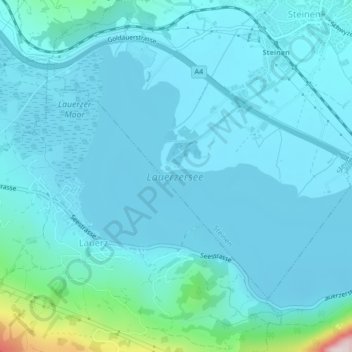
Name: Lauerzersee topographic map, elevation, terrain.

Location: Lauerzersee, Frauholzstrasse, Steinen, Schwyz, 6422, Schweiz (47.02618 8.58371 47.04744 8.62571)

Average elevation: 1,621 ft

Minimum elevation: 1,437 ft

Maximum elevation: 3,186 ft

Gear up for your next adventure:

🪶Fire Starter Kit - Reliable fire starter for survival and camping
🏕️Tent Footprint - Protect your tent base from wear
🛏️Cold Weather Sleeping Bag - Warm sleeping bag for cold conditions
🧭Pro Hiking Compasses - High-accuracy liquid-filled compasses for topographic orientation
🛶Inflatable Kayak - Portable kayak for rivers, lakes, and expeditions

As an Amazon Associate, this site earns from qualifying purchases at no extra cost to you.