Geolocate

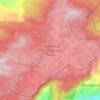
Ambewela topographic map

Click on the map to display elevation.

About this map

Name: Ambewela topographic map, elevation, terrain.

Location: Ambewela, Nuwara Eliya District, Central Province, 90364, Sri Lanka (6.85866 80.79382 6.89866 80.83382)

Average elevation: 5,965 ft

Minimum elevation: 4,573 ft

Maximum elevation: 6,847 ft

Other topographic maps

Click on a map to view its topography, its elevation and its terrain.
Kandy District

Sri Lanka > Central Province

Average elevation: 2,405 ft

Horton Plains National Park

Sri Lanka > Central Province > Nuwara Eliya

Horton Plains National Park (Sinhala: හෝර්ටන් තැන්න ජාතික උද්‍යානය, romanized: Hortan Thanna Jathika Udyanaya) is a national park in the central highlands of Sri Lanka that was designated in 1988. It encompasses an area of 31 km2 (12 sq mi) and borders…

Average elevation: 6,594 ft
Matale District

Sri Lanka > Central Province

Average elevation: 886 ft

Nuwara Eliya District

Sri Lanka > Central Province

Average elevation: 3,586 ft

Kandy District

Sri Lanka > Central Province

Average elevation: 2,405 ft

Matale District

Sri Lanka > Central Province

Average elevation: 886 ft

Sigiriya

Sri Lanka > Central Province

Average elevation: 666 ft

Matale District

Sri Lanka > Central Province

Average elevation: 886 ft

Nanu Oya

Sri Lanka > Central Province > Nanu Oya

Average elevation: 5,869 ft

Nuwara Eliya District

Sri Lanka > Central Province

Average elevation: 3,586 ft

Horton Plains National Park

Sri Lanka > Central Province

Horton Plains National Park (Sinhala: හෝර්ටන් තැන්න ජාතික උද්‍යානය, romanized: Hortan Thanna Jathika Udyanaya) is a national park in the central highlands of Sri Lanka that was designated in 1988. It is located at an elevation of 2,100–2,300 m (6,900–7,500…

Average elevation: 6,594 ft

Kandy District

Sri Lanka > Central Province

Average elevation: 2,405 ft

Horton Plains National Park

Sri Lanka > Central Province

Horton Plains National Park (Sinhala: හෝර්ටන් තැන්න ජාතික උද්‍යානය, romanized: Hortan Thanna Jathika Udyanaya) is a national park in the central highlands of Sri Lanka that was designated in 1988. It covers an area of 31km² and borders Thotupalakanda Nature…

Average elevation: 6,594 ft
Matale District

Sri Lanka > Central Province

Average elevation: 886 ft

Upper Kotmale Dam

Sri Lanka > Central Province > Talawakele > Holyrood

Average elevation: 4,098 ft

Gear up for your next adventure:

🪶Camp Gear Gift Set - Perfect gift bundle for outdoor fans
🛰️Satellite Messengers - Emergency SOS and two-way messaging for off-grid adventures
🥄Camping Utensil Set - Lightweight utensils for outdoor meals
🌄Hiking Binoculars - Compact binoculars for scenic views and trail spotting
📚Navigation Handbooks - Master the art of reading topographic maps and using a compass

As an Amazon Associate, this site earns from qualifying purchases at no extra cost to you.