Geolocate

Brezov topographic map

Click on the map to display elevation.

Brezov

The municipality lies at an altitude of 190 metres (620 ft) and covers an area of 6.89 km2 (2.66 sq mi) (2025).

Wikipedia (CC-BY-SA 3.0)

About this map

Name: Brezov topographic map, elevation, terrain.

Location: Brezov, District of Bardejov, Region of Prešov, Slovakia (49.12623 21.48242 49.15930 21.53679)

Average elevation: 781 ft

Minimum elevation: 574 ft

Maximum elevation: 1,217 ft

Other topographic maps

Click on a map to view its topography, its elevation and its terrain.
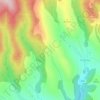
Špane

Slovakia > Region of Prešov > District of Bardejov > Hrabské

Average elevation: 1,850 ft

Špane

Slovakia > Region of Prešov > District of Bardejov > Hrabské

Average elevation: 1,850 ft

Tranka

Slovakia > Region of Prešov > District of Bardejov > Bardejov

Average elevation: 1,473 ft

Gear up for your next adventure:

🧭Orienteering Set - Complete compass and map reading kit
🪶Thermal Camp Blanket - Extra warmth for cold nights
😴Insulated Sleeping Pads - Compact and warm pads for high-elevation camping
🔭Telescopic Hiking Pole - Adjustable pole for hiking stability
📦Dry Bags Set - Waterproof storage for electronics and clothes

As an Amazon Associate, this site earns from qualifying purchases at no extra cost to you.