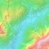
Soča topographic map
Click on the map to display elevation.
Soča
An Alpine river in character, its source lies in the Trenta Valley in the Julian Alps in northwestern Slovenia, at an elevation of 876 metres (2,874 ft). The river runs past the towns of Bovec, Kobarid, Tolmin, Kanal ob Soči, Nova Gorica (where it is crossed by the Solkan Bridge), and Gorizia, entering the Adriatic Sea close to the town of Monfalcone. It has a nival-pluvial regime in its upper course and pluvial-nival in its lower course.
About this map

Name: Soča topographic map, elevation, terrain.
Location: Soča, Bovec, Slovenia (46.32140 13.55324 46.33010 13.57550)
Average elevation: 1,558 ft
Minimum elevation: 1,198 ft
Maximum elevation: 3,373 ft
Other topographic maps
Click on a map to view its topography, its elevation and its terrain.
Bovec
Bovec is located 136 kilometres (85 mi) from the capital Ljubljana, at an elevation of 434 m (1,424 ft). The settlement lies in the Bovec Basin of the upper Soča (Isonzo) River, below the eastern slopes of Mount Kanin in the Julian Alps, forming the border with Italy. The adjacent Trenta Valley in the…
Average elevation: 3,143 ft
Mangart
Mangart or Mangrt is a mountain in the Julian Alps, located on the border between Italy and Slovenia. With an elevation of 2,679 metres (8,789 ft), it is the fourth-highest peak in Slovenia, after Triglav, Škrlatica and Mali Triglav. It was first climbed in 1794 by the naturalist Franz von Hohenwart. Mangart…
Average elevation: 5,906 ft


Strmec na Predelu
Slovenia > Bovec > Log pod Mangartom
Strmec na Predelu (pronounced [ˈstəɾməts na pɾɛˈdeːlu]; Italian: Bretto di Sopra) is a settlement in the Municipality of Bovec in the Littoral region of Slovenia. It lies on the road to the Predel Pass. Another road, distinguished by being the road built at the highest elevation in Slovenia, splits off…
Average elevation: 3,743 ft