Geolocate

Salitran topographic map

Click on the map to display elevation.

About this map
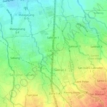
Name: Salitran topographic map, elevation, terrain.

Location: Salitran, Dasmariñas, Cavite, Calabarzon, Philippines (14.33602 120.92984 14.36212 120.96754)

Average elevation: 200 ft

Minimum elevation: 121 ft

Maximum elevation: 312 ft

Gear up for your next adventure:

🎒Outdoor Daypacks - Lightweight backpacks designed for carrying maps and essential gear
🚪Portable Camp Chair - Foldable chair for comfort at camp
🎒Waterproof Dry Bags - Keep your electronics and maps dry inside your pack
☀️Outdoor Sunscreen - High protection sunscreen for outdoor activities
😴Insulated Sleeping Pads - Compact and warm pads for high-elevation camping

As an Amazon Associate, this site earns from qualifying purchases at no extra cost to you.