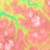
Mærk topographic map
Click on the map to display elevation.
About this map

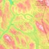
Name: Mærk topographic map, elevation, terrain.
Location: Mærk, Rennebu, Trøndelag, Norway (62.88996 9.77657 62.92996 9.81657)
Average elevation: 1,309 ft
Minimum elevation: 600 ft
Maximum elevation: 2,369 ft
Other topographic maps
Click on a map to view its topography, its elevation and its terrain.










Botn
With a gradually descending bottom slope beneath the inlet, the basin lacks strong internal thresholds (abruptly steepening slopes) that often isolates the deep of fjord basins from imported tidal currents, thus leaving the Botn basin 'hydrodynamically open' (with very weak topographical stratifications).…
Average elevation: 157 ft