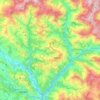
Melamchi topographic map
Click on the map to display elevation.
Melamchi
The lower part of Melamchi valley has a sub-tropical climate, while the upper part has a cool temperate climate. The upper part of the valley receives more rainfall than in the lower part. Heavy rainfall occurs in June, July and August. Rainfall in January and February is the lowest. The annual average rainfall in the Melamchi basin is about 2800 mm, which is concentrated mostly during four months of the monsoon from mid-June to mid-September. Average annual rainfall conditions vary considerably by location in the valley. In general, average annual rainfall is low at lower elevation and is relatively high in the higher elevation. The average annual rainfall recorded for the period of 1991-1996 is 3,410 mm.
About this map

Name: Melamchi topographic map, elevation, terrain.
Location: Melamchi, Sindhupalchowk, Bagamati Province, Nepal (27.78930 85.53613 27.86930 85.61613)
Average elevation: 3,990 ft
Minimum elevation: 2,484 ft
Maximum elevation: 6,739 ft
Other topographic maps
Click on a map to view its topography, its elevation and its terrain.