
Nantachie Lake topographic map
Interactive map
Click on the map to display elevation.
About this map
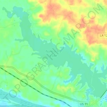
Name: Nantachie Lake topographic map, elevation, terrain.
Location: Nantachie Lake, Grant Parish, Louisiana, United States (31.60373 -92.83455 31.65010 -92.77316)
Average elevation: 128 ft
Minimum elevation: 79 ft
Maximum elevation: 207 ft
Other topographic maps
Click on a map to view its topography, its elevation and its terrain.
Colfax
United States > Louisiana > Grant Parish
Colfax, Grant Parish, Louisiana, United States
Average elevation: 92 ft