Geolocate

Manhattan topographic map

Click on the map to display elevation.

About this map

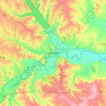
Name: Manhattan topographic map, elevation, terrain.

Location: Manhattan, Riley County, Kansas, 66502-6322, United States (39.02361 -96.73167 39.34361 -96.41167)

Average elevation: 1,198 ft

Minimum elevation: 965 ft

Maximum elevation: 1,522 ft

Riley County trails, hiking, mountain biking, running and outdoor activities

Gear up for your next adventure:

🛰️Handheld GPS Units - Professional satellite navigators for precise backcountry mapping
🌄Hiking Binoculars - Compact binoculars for scenic views and trail spotting
🕶️Glacier Sunglasses - Side shields to protect eyes from high-altitude snow glare
🎁Geography Themed Gifts - Unique gift ideas for map lovers and geography enthusiasts
🎒Outdoor Daypacks - Lightweight backpacks designed for carrying maps and essential gear

As an Amazon Associate, this site earns from qualifying purchases at no extra cost to you.