
Thank you for supporting this site ❤️
Make a donation
Make a donation
Gear up for your next adventure:
As an Amazon Associate, this site earns from qualifying purchases at no extra cost to you.
Amourah topographic map
Click on the map to display elevation.
Thank you for supporting this site ❤️
Make a donation
Make a donation
Gear up for your next adventure:
As an Amazon Associate, this site earns from qualifying purchases at no extra cost to you.
About this map
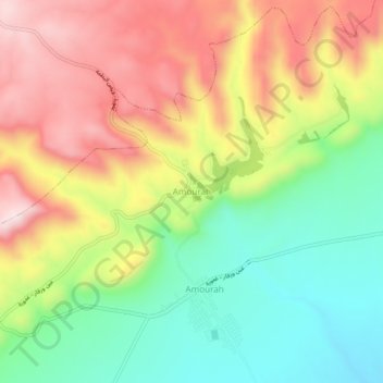
Name: Amourah topographic map, elevation, terrain.
Location: Amourah, Daïra Faïdh El Botma, Djelfa, Algérie (34.33431 3.85086 34.37431 3.89086)
Average elevation: 3,356 ft
Minimum elevation: 2,700 ft
Maximum elevation: 4,111 ft
Thank you for supporting this site ❤️
Make a donation
Make a donation
Gear up for your next adventure:
As an Amazon Associate, this site earns from qualifying purchases at no extra cost to you.