
Barnard topographic map
Click on the map to display elevation.
About this map
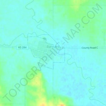
Name: Barnard topographic map, elevation, terrain.
Location: Barnard, Lincoln County, Kansas, 67418, United States (39.18475 -98.05034 39.19306 -98.03812)
Average elevation: 1,332 ft
Minimum elevation: 1,309 ft
Maximum elevation: 1,407 ft
Lincoln County trails, hiking, mountain biking, running and outdoor activities