Geolocate

Santa Rosa de Cabal topographic map

Click on the map to display elevation.

About this map

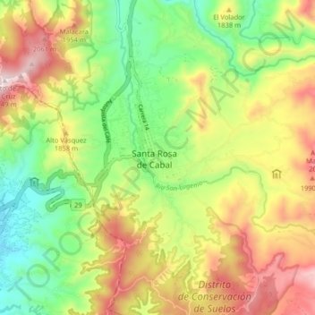
Name: Santa Rosa de Cabal topographic map, elevation, terrain.

Location: Santa Rosa de Cabal, Risaralda, 661020, Colombia (4.82501 -75.66124 4.90501 -75.58124)

Average elevation: 5,804 ft

Minimum elevation: 4,793 ft

Maximum elevation: 7,090 ft

Gear up for your next adventure:

🦶Carbon Trekking Poles - Reduce knee impact on steep descents with ultra-light poles
🏥Hiking First Aid Kits - Comprehensive medical kits for remote trail injuries
🔭Telescopic Hiking Pole - Adjustable pole for hiking stability
🛏️Cold Weather Sleeping Bag - Warm sleeping bag for cold conditions
🪑Portable Camp Table - Compact table for campsite meals

As an Amazon Associate, this site earns from qualifying purchases at no extra cost to you.