
Thank you for supporting this site ❤️
Make a donation
Make a donation
Gear up for your next adventure:
As an Amazon Associate, this site earns from qualifying purchases at no extra cost to you.
Beços topographic map
Click on the map to display elevation.
Thank you for supporting this site ❤️
Make a donation
Make a donation
Gear up for your next adventure:
As an Amazon Associate, this site earns from qualifying purchases at no extra cost to you.
About this map
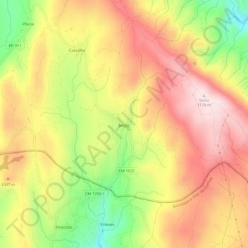
Name: Beços topographic map, elevation, terrain.
Location: Beços, Salto, Montalegre, Vila Real, Portugal (41.57961 -7.93291 41.61961 -7.89291)
Average elevation: 3,251 ft
Minimum elevation: 2,461 ft
Maximum elevation: 3,855 ft
Thank you for supporting this site ❤️
Make a donation
Make a donation
Gear up for your next adventure:
As an Amazon Associate, this site earns from qualifying purchases at no extra cost to you.