Geolocate

Vrabač topographic map

Click on the map to display elevation.

About this map

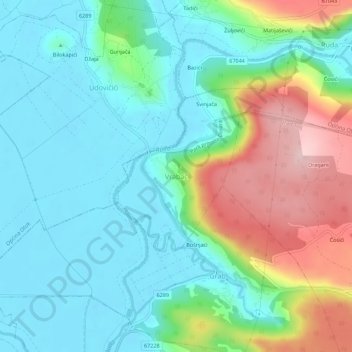
Name: Vrabač topographic map, elevation, terrain.

Location: Vrabač, Grad Trilj, Split-Dalmatia County, 21242, Croatia (43.63719 16.73499 43.67719 16.77499)

Average elevation: 1,165 ft

Minimum elevation: 951 ft

Maximum elevation: 1,680 ft

Gear up for your next adventure:

❄️Traction Cleats - Prevent slips on icy trails during winter hikes
🏔️Mountain Trail Maps - High‑detail maps for popular peaks
🛶Inflatable Kayak - Portable kayak for rivers, lakes, and expeditions
📷Action Camera - Capture your outdoor adventures in HD
🔋Solar Power Banks - Keep your GPS and phone charged in remote wilderness areas

As an Amazon Associate, this site earns from qualifying purchases at no extra cost to you.