
Thank you for supporting this site ❤️
Make a donation
Make a donation
Gear up for your next adventure:
As an Amazon Associate, this site earns from qualifying purchases at no extra cost to you.
Bouhmama topographic map
Click on the map to display elevation.
Thank you for supporting this site ❤️
Make a donation
Make a donation
Gear up for your next adventure:
As an Amazon Associate, this site earns from qualifying purchases at no extra cost to you.
About this map
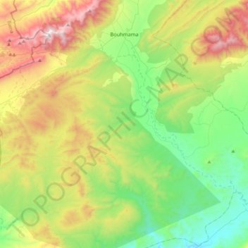
Name: Bouhmama topographic map, elevation, terrain.
Location: Bouhmama, Bouhmama District, Khenchela, 40007, Algeria (35.06521 6.61001 35.35641 6.97390)
Average elevation: 4,226 ft
Minimum elevation: 2,477 ft
Maximum elevation: 7,582 ft
Thank you for supporting this site ❤️
Make a donation
Make a donation
Gear up for your next adventure:
As an Amazon Associate, this site earns from qualifying purchases at no extra cost to you.
Other topographic maps
Click on a map to view its topography, its elevation and its terrain.