
Thank you for supporting this site ❤️
Make a donation
Make a donation
Gear up for your next adventure:
As an Amazon Associate, this site earns from qualifying purchases at no extra cost to you.
Mitturu topographic map
Click on the map to display elevation.
Thank you for supporting this site ❤️
Make a donation
Make a donation
Gear up for your next adventure:
As an Amazon Associate, this site earns from qualifying purchases at no extra cost to you.
About this map
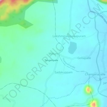
Name: Mitturu topographic map, elevation, terrain.
Location: Mitturu, Bangarupalem, Chittoor, Andhra Pradesh, 517129, India (13.25220 78.91156 13.29220 78.95156)
Average elevation: 1,332 ft
Minimum elevation: 1,234 ft
Maximum elevation: 1,916 ft
Thank you for supporting this site ❤️
Make a donation
Make a donation
Gear up for your next adventure:
As an Amazon Associate, this site earns from qualifying purchases at no extra cost to you.