
Crestline topographic map
Click on the map to display elevation.
About this map
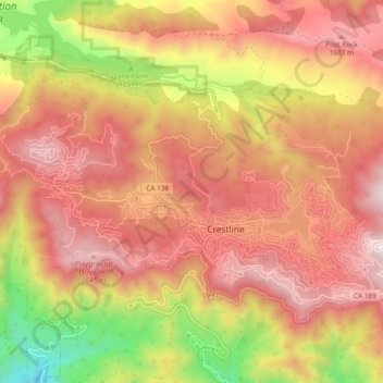
Name: Crestline topographic map, elevation, terrain.
Average elevation: 4,268 ft
Minimum elevation: 2,169 ft
Maximum elevation: 5,666 ft
San Bernardino County trails, hiking, mountain biking, running and outdoor activities
Other topographic maps
Click on a map to view its topography, its elevation and its terrain.
Arrowhead Highlands
United States > California > San Bernardino County > Crestline
Average elevation: 4,610 ft