
Thank you for supporting this site ❤️
Make a donation
Make a donation
Gear up for your next adventure:
As an Amazon Associate, this site earns from qualifying purchases at no extra cost to you.
Asylum topographic map
Click on the map to display elevation.
Thank you for supporting this site ❤️
Make a donation
Make a donation
Gear up for your next adventure:
As an Amazon Associate, this site earns from qualifying purchases at no extra cost to you.
About this map
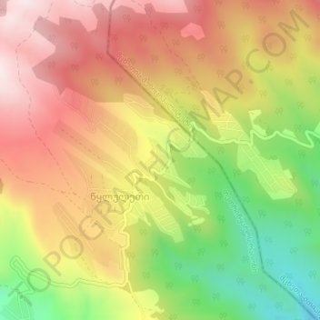
Name: Asylum topographic map, elevation, terrain.
Location: Asylum, შ 159, Didgori Raion, Tbilisi, Georgia (41.71831 44.58560 41.71841 44.58570)
Average elevation: 3,865 ft
Minimum elevation: 2,864 ft
Maximum elevation: 4,682 ft
Thank you for supporting this site ❤️
Make a donation
Make a donation
Gear up for your next adventure:
As an Amazon Associate, this site earns from qualifying purchases at no extra cost to you.