Geolocate

Altitude topographic map

Click on the map to display elevation.

About this map

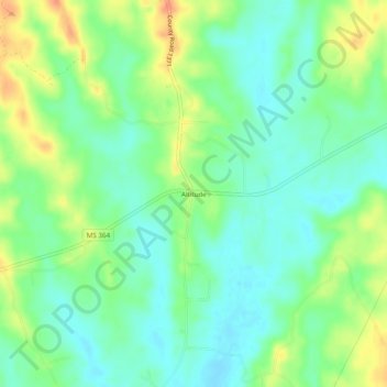
Name: Altitude topographic map, elevation, terrain.

Location: Altitude, Prentiss County, Mississippi, United States (34.64857 -88.46288 34.68857 -88.42288)

Average elevation: 410 ft

Minimum elevation: 354 ft

Maximum elevation: 495 ft

Prentiss County trails, hiking, mountain biking, running and outdoor activities

Gear up for your next adventure:

👟Men's Trail Runners - Lightweight footwear for fast-paced exploration and light hiking
🔭Stargazing Telescopes - Perfect for camping in low-light pollution areas shown on maps
🔋Solar Power Banks - Keep your GPS and phone charged in remote wilderness areas
🧢Sun Protection Hats - Wide-brimmed and UPF-rated hats for high-altitude sun safety
🌄Hiking Binoculars - Compact binoculars for scenic views and trail spotting

As an Amazon Associate, this site earns from qualifying purchases at no extra cost to you.