
Thank you for supporting this site ❤️
Make a donation
Make a donation
Gear up for your next adventure:
As an Amazon Associate, this site earns from qualifying purchases at no extra cost to you.
Bosost topographic map
Click on the map to display elevation.
Thank you for supporting this site ❤️
Make a donation
Make a donation
Gear up for your next adventure:
As an Amazon Associate, this site earns from qualifying purchases at no extra cost to you.
About this map
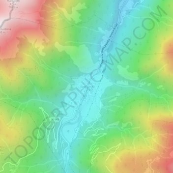
Name: Bosost topographic map, elevation, terrain.
Location: Bosost, Bossòst, Valle de Arán, Lérida, Cataluña, 25550, España (42.76599 0.67312 42.80599 0.71312)
Average elevation: 3,684 ft
Minimum elevation: 2,119 ft
Maximum elevation: 6,529 ft
Thank you for supporting this site ❤️
Make a donation
Make a donation
Gear up for your next adventure:
As an Amazon Associate, this site earns from qualifying purchases at no extra cost to you.