
Pulong Bunga topographic map
Click on the map to display elevation.
About this map
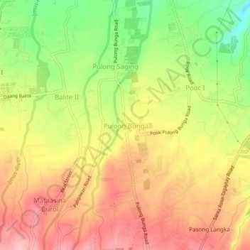
Name: Pulong Bunga topographic map, elevation, terrain.
Location: Pulong Bunga, Silang, Cavite, Calabarzon, 4118, Philippines (14.15870 120.96388 14.19870 121.00388)
Average elevation: 1,335 ft
Minimum elevation: 1,024 ft
Maximum elevation: 1,581 ft
Other topographic maps
Click on a map to view its topography, its elevation and its terrain.