Geolocate

Pilcos topographic map

Click on the map to display elevation.

About this map

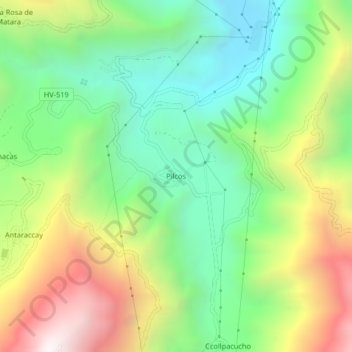
Name: Pilcos topographic map, elevation, terrain.

Location: Pilcos, Colcabamba, Tayacaja, Huancavelica, Perú (-12.41803 -74.67656 -12.37803 -74.63656)

Average elevation: 9,124 ft

Minimum elevation: 7,218 ft

Maximum elevation: 12,172 ft

Gear up for your next adventure:

🔋Solar Power Banks - Keep your GPS and phone charged in remote wilderness areas
🥾Men's Hiking Boots - Durable, waterproof footwear for rugged terrain and steep inclines
🔦LED Headlamp - Bright and durable LED headlamp for night navigation
🛶Inflatable Kayak - Portable kayak for rivers, lakes, and expeditions
🧯Emergency Survival Kit - All‑in‑one survival essentials for the backcountry

As an Amazon Associate, this site earns from qualifying purchases at no extra cost to you.