
Thank you for supporting this site ❤️
Make a donation
Make a donation
Gear up for your next adventure:
As an Amazon Associate, this site earns from qualifying purchases at no extra cost to you.
Phata topographic map
Click on the map to display elevation.
Thank you for supporting this site ❤️
Make a donation
Make a donation
Gear up for your next adventure:
As an Amazon Associate, this site earns from qualifying purchases at no extra cost to you.
About this map
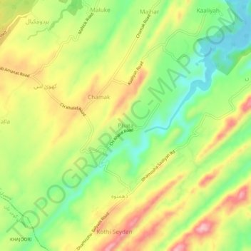
Name: Phata topographic map, elevation, terrain.
Location: Phata, Tehsil Kallar Syedan, Punjab, KS26 2AA, Pakistan (33.31089 73.50715 33.35089 73.54715)
Average elevation: 1,453 ft
Minimum elevation: 1,155 ft
Maximum elevation: 1,791 ft
Thank you for supporting this site ❤️
Make a donation
Make a donation
Gear up for your next adventure:
As an Amazon Associate, this site earns from qualifying purchases at no extra cost to you.