
Make a donation
Gear up for your next adventure:
As an Amazon Associate, this site earns from qualifying purchases at no extra cost to you.
Goodview topographic map
Click on the map to display elevation.
Make a donation
Gear up for your next adventure:
As an Amazon Associate, this site earns from qualifying purchases at no extra cost to you.
About this map
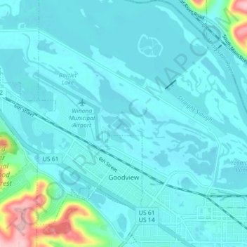
Name: Goodview topographic map, elevation, terrain.
Location: Goodview, Winona County, Minnesota, 55959, United States (44.05223 -91.76048 44.09373 -91.68979)
Average elevation: 696 ft
Minimum elevation: 627 ft
Maximum elevation: 1,204 ft
Winona County trails, hiking, mountain biking, running and outdoor activities
Make a donation
Gear up for your next adventure:
As an Amazon Associate, this site earns from qualifying purchases at no extra cost to you.
Other topographic maps
Click on a map to view its topography, its elevation and its terrain.
Country Valley Mobile Home Park
United States > Minnesota > Winona County > Goodview
Average elevation: 758 ft