Geolocate

Lake Merced topographic map

Click on the map to display elevation.

About this map

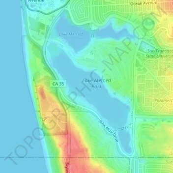
Name: Lake Merced topographic map, elevation, terrain.

Location: Lake Merced, San Francisco, California, United States (37.71259 -122.50246 37.72609 -122.48597)

Average elevation: 62 ft

Minimum elevation: -30 ft

Maximum elevation: 233 ft

San Francisco trails, hiking, mountain biking, running and outdoor activities

Gear up for your next adventure:

🪶Compact Camp Shovel - Folding shovel for campsite tasks
🦶Carbon Trekking Poles - Reduce knee impact on steep descents with ultra-light poles
🔥Fast-Boil Camping Stoves - Efficient cooking systems for quick trail meals
🥾Men's Hiking Boots - Durable, waterproof footwear for rugged terrain and steep inclines
🧯Portable Fire Pit - Compact fire pit for camping spots

As an Amazon Associate, this site earns from qualifying purchases at no extra cost to you.