
Parham topographic map
Click on the map to display elevation.
About this map
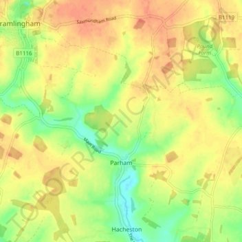
Name: Parham topographic map, elevation, terrain.
Location: Parham, East Suffolk, Suffolk, England, United Kingdom (52.17998 1.35049 52.22652 1.40161)
Average elevation: 121 ft
Minimum elevation: 36 ft
Maximum elevation: 184 ft
Other topographic maps
Click on a map to view its topography, its elevation and its terrain.
Falkenham Marshes
United Kingdom > England > Suffolk > East Suffolk > Falkenham
Average elevation: 0 ft
Felixstowe Marshes
United Kingdom > England > Suffolk > East Suffolk > Felixstowe
Average elevation: 3 ft