Geolocate

Bishopstoke topographic map

Click on the map to display elevation.

About this map

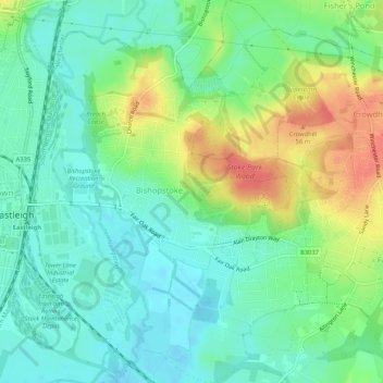
Name: Bishopstoke topographic map, elevation, terrain.

Location: Bishopstoke, Eastleigh, Hampshire, England, United Kingdom (50.95465 -1.34658 50.98766 -1.30479)

Average elevation: 82 ft

Minimum elevation: 16 ft

Maximum elevation: 203 ft

Gear up for your next adventure:

🥘Titanium Cookware - Durable, featherlight pots and pans for backpacking
🧥Men's Rain Shells - Premium waterproof and breathable jackets for mountain weather
🧭Orienteering Set - Complete compass and map reading kit
🚁Photography Drones - Capture stunning aerial views of landforms and topography
🧢Outdoor Hiking Hat - Sun protection hat for outdoor explorers

As an Amazon Associate, this site earns from qualifying purchases at no extra cost to you.