Geolocate

Adi Quala topographic map

Click on the map to display elevation.

About this map

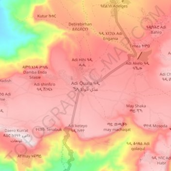
Name: Adi Quala topographic map, elevation, terrain.

Location: Adi Quala, Debub Region, Eritrea (14.59380 38.79356 14.67380 38.87356)

Average elevation: 6,450 ft

Minimum elevation: 5,240 ft

Maximum elevation: 6,965 ft

Other topographic maps

Click on a map to view its topography, its elevation and its terrain.

Adi halo

Eritrea > Debub Region

Average elevation: 6,417 ft

Mereb river

Eritrea > Debub Region

Average elevation: 4,646 ft

Mereb river ሩባ መረብ

Eritrea > Debub Region

Average elevation: 4,774 ft

Ma'ereba

Eritrea > Debub Region

Average elevation: 6,890 ft

Mereb river

Eritrea > Debub Region

Average elevation: 4,892 ft

Gear up for your next adventure:

🏕️Tent Footprint - Protect your tent base from wear
🧷Carabiner Set - Durable clips for gear attachment
🪶Compact Camp Shovel - Folding shovel for campsite tasks
📱Heavy-Duty Phone Cases - Drop-proof and waterproof protection for outdoor navigation
📷Action Cameras - Rugged cameras to document your journeys across rugged terrain

As an Amazon Associate, this site earns from qualifying purchases at no extra cost to you.