
Thank you for supporting this site ❤️
Make a donation
Make a donation
Gear up for your next adventure:
As an Amazon Associate, this site earns from qualifying purchases at no extra cost to you.
Wilere topographic map
Click on the map to display elevation.
Thank you for supporting this site ❤️
Make a donation
Make a donation
Gear up for your next adventure:
As an Amazon Associate, this site earns from qualifying purchases at no extra cost to you.
About this map
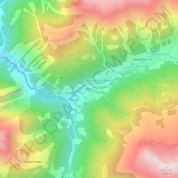
Name: Wilere topographic map, elevation, terrain.
Location: Wilere, Schmidighischere, Binn, Goms, Wallis, 3996, Switzerland (46.34252 8.16129 46.38252 8.20129)
Average elevation: 5,948 ft
Minimum elevation: 3,999 ft
Maximum elevation: 8,369 ft
Thank you for supporting this site ❤️
Make a donation
Make a donation
Gear up for your next adventure:
As an Amazon Associate, this site earns from qualifying purchases at no extra cost to you.