Geolocate

Puy topographic map

Click on the map to display elevation.

About this map

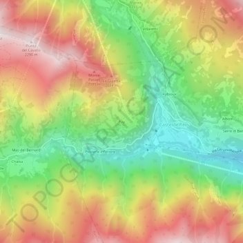
Name: Puy topographic map, elevation, terrain.

Location: Puy, Casteldelfino, Cuneo, Piedmont, Italy (44.57012 7.03825 44.61012 7.07825)

Average elevation: 5,636 ft

Minimum elevation: 3,930 ft

Maximum elevation: 7,497 ft

Gear up for your next adventure:

🔭Telescopic Hiking Pole - Adjustable pole for hiking stability
🪶Camp Gear Gift Set - Perfect gift bundle for outdoor fans
😴Insulated Sleeping Pads - Compact and warm pads for high-elevation camping
🛰️Handheld GPS Units - Professional satellite navigators for precise backcountry mapping
🛏️Cold Weather Sleeping Bag - Warm sleeping bag for cold conditions

As an Amazon Associate, this site earns from qualifying purchases at no extra cost to you.