Geolocate

The Head topographic map

Click on the map to display elevation.

About this map

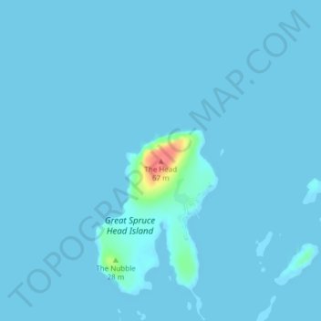
Name: The Head topographic map, elevation, terrain.

Location: The Head, Deer Isle, Hancock County, Maine, United States (44.24003 -68.82341 44.24013 -68.82331)

Average elevation: 7 ft

Minimum elevation: -13 ft

Maximum elevation: 203 ft

Gear up for your next adventure:

⛑️Personal Locator Beacon - Safety beacon for emergencies
👟Men's Trail Runners - Lightweight footwear for fast-paced exploration and light hiking
🌲Outdoor Survival Books - Best books on survival skills
🩹Survival Bandages - High‑quality bandages for emergencies
🧭Compass with Lanyard - Easy‑carry compass for navigation

As an Amazon Associate, this site earns from qualifying purchases at no extra cost to you.