
Thank you for supporting this site ❤️
Make a donation
Make a donation
Gear up for your next adventure:
As an Amazon Associate, this site earns from qualifying purchases at no extra cost to you.
Rajouri topographic map
Click on the map to display elevation.
Thank you for supporting this site ❤️
Make a donation
Make a donation
Gear up for your next adventure:
As an Amazon Associate, this site earns from qualifying purchases at no extra cost to you.
About this map
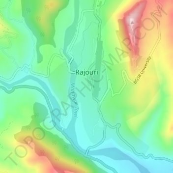
Name: Rajouri topographic map, elevation, terrain.
Location: Rajouri, Rajauri, Rajouri District, Jammu and Kashmir, India (33.36350 74.30579 33.38618 74.32413)
Average elevation: 3,159 ft
Minimum elevation: 2,835 ft
Maximum elevation: 3,786 ft
Thank you for supporting this site ❤️
Make a donation
Make a donation
Gear up for your next adventure:
As an Amazon Associate, this site earns from qualifying purchases at no extra cost to you.