
Mound Key topographic map
Click on the map to display elevation.
About this map
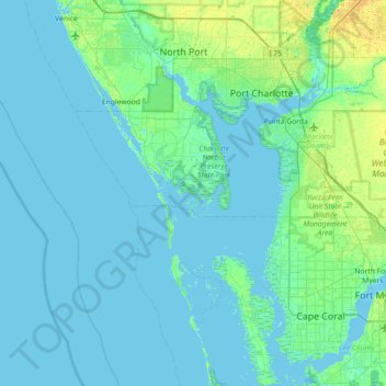
Name: Mound Key topographic map, elevation, terrain.
Location: Mound Key, Charlotte County, Florida, United States (26.48951 -82.53843 27.12951 -81.89843)
Average elevation: 10 ft
Minimum elevation: -7 ft
Maximum elevation: 56 ft
Charlotte County trails, hiking, mountain biking, running and outdoor activities
Other topographic maps
Click on a map to view its topography, its elevation and its terrain.
Gilcrest Park
United States > Florida > Charlotte County > Punta Gorda > Fishermens Village
Average elevation: 7 ft
Ainger Creek Park
United States > Florida > Charlotte County > Englewood > New Point Comfort
Average elevation: 10 ft
Harbour Heights
United States > Florida > Charlotte County > Punta Gorda > Harbour Heights
Average elevation: 13 ft