
丹巴县 topographic map
Interactive map
Click on the map to display elevation.
About this map
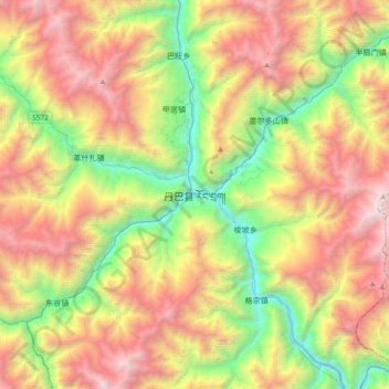
Name: 丹巴县 topographic map, elevation, terrain.
Location: 丹巴县, 甘孜藏族自治州, 四川省, 中国 (30.72136 101.72458 31.04136 102.04458)
Average elevation: 10,686 ft
Minimum elevation: 5,840 ft
Maximum elevation: 16,936 ft
丹巴县(藏文:རོང་བྲག། /,藏语拼音:Rongzhag / Rongxar),位于四川甘孜藏族自治州东部,人口约7万(2000年),县城海拔1800米,著名景点有美人谷、党岭、古碉等。
Other topographic maps
Click on a map to view its topography, its elevation and its terrain.