Geolocate

Roborough topographic map

Click on the map to display elevation.

About this map

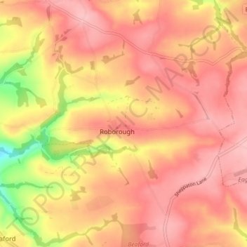
Name: Roborough topographic map, elevation, terrain.

Location: Roborough, Torridge District, Devon, England, United Kingdom (50.91795 -4.06361 50.95582 -3.99320)

Average elevation: 522 ft

Minimum elevation: 230 ft

Maximum elevation: 653 ft

Other topographic maps

Click on a map to view its topography, its elevation and its terrain.

Earthquake

United Kingdom > England > Devon > Torridge District

Average elevation: 115 ft

Clawton

United Kingdom > England > Devon > Torridge District

Average elevation: 420 ft

Riddlecombe

United Kingdom > England > Devon > Torridge District

Average elevation: 512 ft

Derril

United Kingdom > England > Devon > Torridge District > Pyworthy

Average elevation: 417 ft

Westward Ho!

United Kingdom > England > Devon > Torridge District

Average elevation: 75 ft

Chilsworthy

United Kingdom > England > Devon > Torridge District

Average elevation: 456 ft

Venngreen

United Kingdom > England > Devon > Torridge District

Average elevation: 489 ft

Horns Cross

United Kingdom > England > Devon > Torridge District

Average elevation: 367 ft

Taddiport

United Kingdom > England > Devon > Torridge District

Average elevation: 279 ft

Stibb Cross

United Kingdom > England > Devon > Torridge District

Average elevation: 515 ft

Ashmill

United Kingdom > England > Devon > Torridge District > Ashwater

Average elevation: 512 ft

Stoke

United Kingdom > England > Devon > Torridge District > Hartland

Average elevation: 249 ft

Woodacott

United Kingdom > England > Devon > Torridge District > Thornbury

Average elevation: 453 ft

Hollocombe

United Kingdom > England > Devon > Torridge District

Average elevation: 489 ft

Appledore

United Kingdom > England > Devon > Torridge District

Average elevation: 62 ft

Churchtown

United Kingdom > England > Devon > Torridge District

Average elevation: 377 ft

Appledore

United Kingdom > England > Devon > Torridge District

Average elevation: 69 ft

Diddywells

United Kingdom > England > Devon > Torridge District > Northam

Average elevation: 62 ft

Gear up for your next adventure:

🔦LED Headlamp - Bright and durable LED headlamp for night navigation
🧭Compass with Lanyard - Easy‑carry compass for navigation
📚USA Hiking Guide Books - Top trail guides and map books
🧯Emergency Survival Kit - All‑in‑one survival essentials for the backcountry
🌧️Backpack Rain Cover - Keep gear dry in wet weather

As an Amazon Associate, this site earns from qualifying purchases at no extra cost to you.