Geolocate

Coppell topographic map

Click on the map to display elevation.

About this map

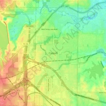
Name: Coppell topographic map, elevation, terrain.

Location: Coppell, Dallas County, Texas, 75019, United States (32.91526 -97.05557 32.99526 -96.97557)

Average elevation: 525 ft

Minimum elevation: 433 ft

Maximum elevation: 630 ft

Dallas County trails, hiking, mountain biking, running and outdoor activities

Gear up for your next adventure:

🛡️Bear Spray Outdoor - Protection in bear country hikes
📷Action Camera - Capture your outdoor adventures in HD
📶Satellite Messenger - Communication device off‑grid
😴Insulated Sleeping Pads - Compact and warm pads for high-elevation camping
🌐World Map Poster - Decorative world maps with topographic info

As an Amazon Associate, this site earns from qualifying purchases at no extra cost to you.