Geolocate

Douglas topographic map

Click on the map to display elevation.

About this map

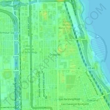
Name: Douglas topographic map, elevation, terrain.

Location: Douglas, Chicago, Cook County, Illinois, United States (41.82368 -87.62980 41.84573 -87.60085)

Average elevation: 597 ft

Minimum elevation: 574 ft

Maximum elevation: 623 ft

Cook County trails, hiking, mountain biking, running and outdoor activities

Other topographic maps

Click on a map to view its topography, its elevation and its terrain.

Cascade Park

United States > Illinois > Cook County > Chicago

Average elevation: 597 ft

Goose Island

United States > Illinois > Cook County > Chicago

Average elevation: 597 ft

Grant Park

United States > Illinois > Cook County > Chicago

Average elevation: 597 ft

Durkin Park

United States > Illinois > Cook County > Chicago

Average elevation: 623 ft

Valley Forge Park

United States > Illinois > Cook County > Chicago

Average elevation: 614 ft

Ogden Slip

United States > Illinois > Cook County > Chicago

Average elevation: 594 ft

Columbia Basin

United States > Illinois > Cook County > Chicago

Average elevation: 591 ft

Evergreen Park

United States > Illinois > Cook County > Chicago

Average elevation: 600 ft

Gear up for your next adventure:

🧺Microfiber Travel Towels - Compact and fast-drying towels for trail use
🚪Portable Camp Chair - Foldable chair for comfort at camp
📡GPS Antenna Upgrade - Enhance GPS reception in remote terrain
🗃️Trail First Aid Kit - Essential kit for outdoor injuries and emergencies
📻Weather Alert Radios - Stay informed of storm risks while off-the-grid

As an Amazon Associate, this site earns from qualifying purchases at no extra cost to you.