Geolocate

Ingham topographic map

Click on the map to display elevation.

About this map

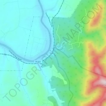
Name: Ingham topographic map, elevation, terrain.

Location: Ingham, Page County, Virginia, 22849, United States (38.50901 -78.59807 38.54901 -78.55807)

Average elevation: 1,184 ft

Minimum elevation: 814 ft

Maximum elevation: 2,388 ft

Page County trails, hiking, mountain biking, running and outdoor activities

Gear up for your next adventure:

🔌Solar Panel Charger - Charge gear sustainably outdoors
🦺Reflective Outdoor Gear - Safety gear for low‑light conditions
🚑Emergency Bivvies - Heat-reflective sleeping bags for survival situations
🎒Trail Energy Bars - High‑calorie bars for hiking energy
🪑Portable Camp Table - Compact table for campsite meals

As an Amazon Associate, this site earns from qualifying purchases at no extra cost to you.