Geolocate

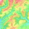
Utscheid topographic map

Click on the map to display elevation.

About this map

Name: Utscheid topographic map, elevation, terrain.

Location: Utscheid, Südeifel, Eifelkreis Bitburg-Prüm, Rijnland-Palts, Duitsland (49.97550 6.33092 50.01175 6.37156)

Average elevation: 1,260 ft

Minimum elevation: 935 ft

Maximum elevation: 1,627 ft

Other topographic maps

Click on a map to view its topography, its elevation and its terrain.

Buscht

Duitsland > Rijnland-Palts > Eifelkreis Bitburg-Prüm

Average elevation: 1,234 ft

Gear up for your next adventure:

🧢Sun Protection Hats - Wide-brimmed and UPF-rated hats for high-altitude sun safety
⛺Backpacking Tents - Weight-optimized shelters for multi-day topographic surveys
🌐World Map Poster - Decorative world maps with topographic info
🔋Solar Power Banks - Keep your GPS and phone charged in remote wilderness areas
🧯Portable Fire Pit - Compact fire pit for camping spots

As an Amazon Associate, this site earns from qualifying purchases at no extra cost to you.