
Thank you for supporting this site ❤️
Make a donation
Make a donation
Gear up for your next adventure:
As an Amazon Associate, this site earns from qualifying purchases at no extra cost to you.
Chiattera topographic map
Click on the map to display elevation.
Thank you for supporting this site ❤️
Make a donation
Make a donation
Gear up for your next adventure:
As an Amazon Associate, this site earns from qualifying purchases at no extra cost to you.
About this map
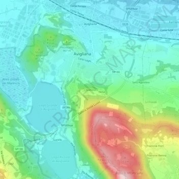
Name: Chiattera topographic map, elevation, terrain.
Location: Chiattera, Avigliana, Torino, Piemont, 10051, Italy (45.04989 7.38074 45.08989 7.42074)
Average elevation: 1,335 ft
Minimum elevation: 1,086 ft
Maximum elevation: 2,054 ft
Thank you for supporting this site ❤️
Make a donation
Make a donation
Gear up for your next adventure:
As an Amazon Associate, this site earns from qualifying purchases at no extra cost to you.