
Thank you for supporting this site ❤️
Make a donation
Make a donation
Gear up for your next adventure:
As an Amazon Associate, this site earns from qualifying purchases at no extra cost to you.
Caragral topographic map
Click on the map to display elevation.
Thank you for supporting this site ❤️
Make a donation
Make a donation
Gear up for your next adventure:
As an Amazon Associate, this site earns from qualifying purchases at no extra cost to you.
About this map
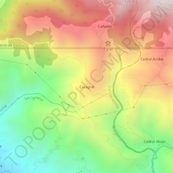
Name: Caragral topographic map, elevation, terrain.
Location: Caragral, Palmichal, Acosta, San José, 11203, Costa Rica (9.80542 -84.16796 9.84542 -84.12796)
Average elevation: 5,358 ft
Minimum elevation: 3,097 ft
Maximum elevation: 7,661 ft
Thank you for supporting this site ❤️
Make a donation
Make a donation
Gear up for your next adventure:
As an Amazon Associate, this site earns from qualifying purchases at no extra cost to you.