Geolocate

Mollem topographic map

Click on the map to display elevation.

About this map

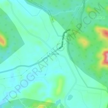
Name: Mollem topographic map, elevation, terrain.

Location: Mollem, Dharbandora, South Goa, Goa, 403410, India (15.35501 74.20685 15.39501 74.24685)

Average elevation: 282 ft

Minimum elevation: 161 ft

Maximum elevation: 741 ft

Other topographic maps

Click on a map to view its topography, its elevation and its terrain.

Codli

India > Goa > Dharbandora

Average elevation: 217 ft

Gear up for your next adventure:

📱Heavy-Duty Phone Cases - Drop-proof and waterproof protection for outdoor navigation
🗺️Topographic Maps - Detailed topo maps for hiking, exploring and outdoor navigation
🚁Photography Drones - Capture stunning aerial views of landforms and topography
🎒Hydration Pack - Hands‑free water reservoir for long hikes
🎁Geography Themed Gifts - Unique gift ideas for map lovers and geography enthusiasts

As an Amazon Associate, this site earns from qualifying purchases at no extra cost to you.