
Thank you for supporting this site ❤️
Make a donation
Make a donation
Gear up for your next adventure:
As an Amazon Associate, this site earns from qualifying purchases at no extra cost to you.
Dienstedt topographic map
Click on the map to display elevation.
Thank you for supporting this site ❤️
Make a donation
Make a donation
Gear up for your next adventure:
As an Amazon Associate, this site earns from qualifying purchases at no extra cost to you.
About this map
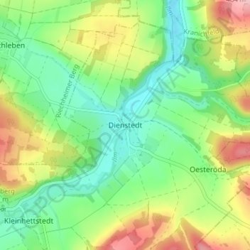
Name: Dienstedt topographic map, elevation, terrain.
Location: Dienstedt, Stadtilm, Ilm-Kreis, Thuringia, 99326, Germany (50.78448 11.14726 50.82448 11.18726)
Average elevation: 1,217 ft
Minimum elevation: 1,030 ft
Maximum elevation: 1,526 ft
Thank you for supporting this site ❤️
Make a donation
Make a donation
Gear up for your next adventure:
As an Amazon Associate, this site earns from qualifying purchases at no extra cost to you.
Other topographic maps
Click on a map to view its topography, its elevation and its terrain.