
Thank you for supporting this site ❤️
Make a donation
Make a donation
Gear up for your next adventure:
As an Amazon Associate, this site earns from qualifying purchases at no extra cost to you.
Mollepata topographic map
Click on the map to display elevation.
Thank you for supporting this site ❤️
Make a donation
Make a donation
Gear up for your next adventure:
As an Amazon Associate, this site earns from qualifying purchases at no extra cost to you.
About this map
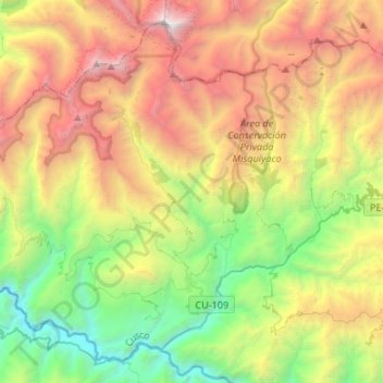
Name: Mollepata topographic map, elevation, terrain.
Location: Mollepata, Province of Anta, Cusco, 08645, Peru (-13.56276 -72.77286 -13.33261 -72.50542)
Average elevation: 11,732 ft
Minimum elevation: 5,820 ft
Maximum elevation: 20,433 ft
Thank you for supporting this site ❤️
Make a donation
Make a donation
Gear up for your next adventure:
As an Amazon Associate, this site earns from qualifying purchases at no extra cost to you.