
Des Moines topographic map
Click on the map to display elevation.
About this map
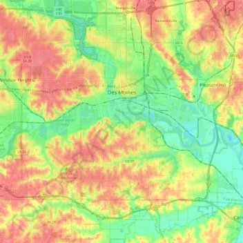
Name: Des Moines topographic map, elevation, terrain.
Location: Des Moines, Polk County, Iowa, United States (41.47964 -93.70914 41.65891 -93.49369)
Average elevation: 866 ft
Minimum elevation: 748 ft
Maximum elevation: 994 ft
Polk County trails, hiking, mountain biking, running and outdoor activities