Geolocate

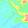
Neekreen topographic map

Click on the map to display elevation.

About this map

Name: Neekreen topographic map, elevation, terrain.

Location: Neekreen, Grand Bassa County, Liberia (5.78755 -10.06851 6.07082 -9.79437)

Average elevation: 105 ft

Minimum elevation: -7 ft

Maximum elevation: 1,129 ft

Other topographic maps

Click on a map to view its topography, its elevation and its terrain.

Lemuel Reevesbli

Liberia > Grand Bassa County > District 2

Average elevation: 384 ft

Photo

Liberia > Grand Bassa County > District 2

Average elevation: 509 ft

Nour

Liberia > Grand Bassa County > Neekreen

Average elevation: 118 ft

Mandeh

Liberia > Grand Bassa County > Neekreen

Average elevation: 223 ft

New

Liberia > Grand Bassa County > St. John River City > Hartford

Average elevation: 46 ft

Noway

Liberia > Grand Bassa County > St. John River City

Average elevation: 266 ft

Wilmot Village

Liberia > Grand Bassa County > Neekreen

Average elevation: 82 ft

Paper

Liberia > Grand Bassa County > District 1

Average elevation: 292 ft

Kru

Liberia > Grand Bassa County > Owensgrove

Average elevation: 92 ft

Willybli

Liberia > Grand Bassa County > District # 4

Average elevation: 328 ft

Photo

Liberia > Grand Bassa County > District 2

Average elevation: 509 ft

Mattin Village

Liberia > Grand Bassa County > Owensgrove

Average elevation: 69 ft

Gear up for your next adventure:

🔥Plasma Lighters - Windproof lighters that work in any weather condition
🪶Compact Camp Shovel - Folding shovel for campsite tasks
🦶Hiking Gaiters - Keep debris and water out of your boots
🪑Portable Camp Table - Compact table for campsite meals
🌎3D Topographic Globes - Raised relief globes for a tactile understanding of geography

As an Amazon Associate, this site earns from qualifying purchases at no extra cost to you.