
Thank you for supporting this site ❤️
Make a donation
Make a donation
Gear up for your next adventure:
As an Amazon Associate, this site earns from qualifying purchases at no extra cost to you.
Möhnesee topographic map
Click on the map to display elevation.
Thank you for supporting this site ❤️
Make a donation
Make a donation
Gear up for your next adventure:
As an Amazon Associate, this site earns from qualifying purchases at no extra cost to you.
About this map
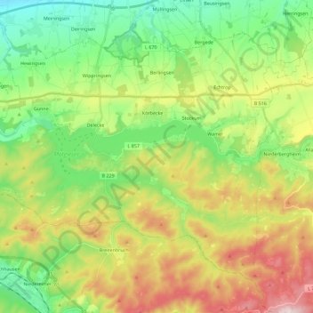
Name: Möhnesee topographic map, elevation, terrain.
Location: Möhnesee, Kreis Soest, North Rhine-Westphalia, 59519, Germany (51.42225 8.01131 51.53306 8.23657)
Average elevation: 869 ft
Minimum elevation: 371 ft
Maximum elevation: 1,686 ft
Thank you for supporting this site ❤️
Make a donation
Make a donation
Gear up for your next adventure:
As an Amazon Associate, this site earns from qualifying purchases at no extra cost to you.
Other topographic maps
Click on a map to view its topography, its elevation and its terrain.