Geolocate

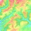
Irrel topographic map

Click on the map to display elevation.

About this map

Name: Irrel topographic map, elevation, terrain.

Location: Irrel, Südeifel, Eifelkreis Bitburg-Prüm, Rijnland-Palts, 54666, Duitsland (49.82764 6.43194 49.86208 6.48875)

Average elevation: 850 ft

Minimum elevation: 515 ft

Maximum elevation: 1,161 ft

Other topographic maps

Click on a map to view its topography, its elevation and its terrain.

Buscht

Duitsland > Rijnland-Palts > Eifelkreis Bitburg-Prüm

Average elevation: 1,234 ft

Gear up for your next adventure:

📡Handheld GPS Device - Reliable handheld GPS for outdoor navigation
🔦Powerful Headlamps - Ultra-bright hands-free lighting for night navigation
👓Polarized Sunglasses - Outdoor sunglasses for glare reduction
🌄Hiking Binoculars - Compact binoculars for scenic views and trail spotting
🖼️Topo Map Wall Art - Decorative topographic prints of famous peaks and regions

As an Amazon Associate, this site earns from qualifying purchases at no extra cost to you.