Geolocate

Trapiche topographic map

Click on the map to display elevation.

About this map

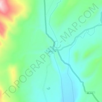
Name: Trapiche topographic map, elevation, terrain.

Location: Trapiche, Ananea, San Antonio de Putina, Puno, Peru (-14.77820 -69.43347 -14.73820 -69.39347)

Average elevation: 15,157 ft

Minimum elevation: 14,875 ft

Maximum elevation: 15,978 ft

Gear up for your next adventure:

🎒Trekking Poles - Sturdy poles for balance and stability on rough terrain
🧢Outdoor Hiking Hat - Sun protection hat for outdoor explorers
🧤Hiking Gloves - Protective gloves for rugged trails
🍳Camping Cook Set - Complete cookware for outdoor meals
🕶️Glacier Sunglasses - Side shields to protect eyes from high-altitude snow glare

As an Amazon Associate, this site earns from qualifying purchases at no extra cost to you.