
Thank you for supporting this site ❤️
Make a donation
Make a donation
Gear up for your next adventure:
As an Amazon Associate, this site earns from qualifying purchases at no extra cost to you.
Geisenheim topographic map
Click on the map to display elevation.
Thank you for supporting this site ❤️
Make a donation
Make a donation
Gear up for your next adventure:
As an Amazon Associate, this site earns from qualifying purchases at no extra cost to you.
About this map
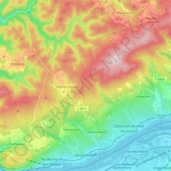
Name: Geisenheim topographic map, elevation, terrain.
Location: Geisenheim, Rheingau-Taunus-Kreis, Hesse, 65366, Germany (49.97498 7.88261 50.09746 7.99220)
Average elevation: 1,001 ft
Minimum elevation: 256 ft
Maximum elevation: 2,054 ft
Thank you for supporting this site ❤️
Make a donation
Make a donation
Gear up for your next adventure:
As an Amazon Associate, this site earns from qualifying purchases at no extra cost to you.